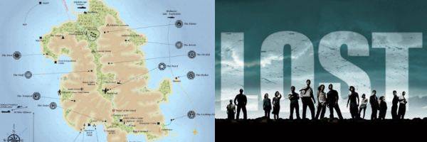
Various attempts to map out the island of Lost have been posted to the internet over the show's six-year run, but none arguably have quite the legitimacy as this map from cartographer Jonah M. Adkins. He has been working on the map (alongside his less important projects for, you know, the government) since the summer of 2006, and finalized it once the show ended in May. Check out the map, as well as how you can get one of your own, after the jump.
Information on how to purchase prints of the map can be found at the Adkins' site. Click on the image for a high resolution version.

Adkins explained some of the complexities of the project in an e-mail to EW:
“You start with an image/satellite photo, in this case an image of Rousseau’s map from a few seasons back."
"So much went into using the dialogue from the show to get geographic details."
"Sometimes it would take a group of people to get from point A to point B minutes on the show one time, then days the next time. Sometimes the camera shots would depict the water on different sides of a feature in the same scene."
"I didn’t place Jacob’s cabin simply because most of the time it was shown, it was in a different place.”